 For the past five days, almost every waking hour has been focused
in one way or another on the giant squid. We have thawed, we have
measured, we have dissected, we have photographed and we have
tried without all too much success, to wash the remnants of
all these activities off of our bodies and clothes. Every once in
a while when we get into a taxi cab, or find ourselves in a very
small and painfully slow elevator, one of us invariably will turn
to the others and smile, knowing full well that we all know what
that means. We have all vowed that by the end of the week we
will find ourselves a laundromat and have everything that has come
within 10 feet of a squid thoroughly washed...several times if needed.
With all of this squid-focused activity of late, I have at times forgotten
that my real job is that of an
oceanographer
, and one that more
often uses satellites and computers to carry out my work, than the
scalpels, formalin and measuring tape that have been of so much use this
past week. However, today I had a chance to meet for the first time one
of the many people whom I have "worked" with over the years but have
never actually met. Science these days often involves collaborations with
fellow scientists around the world and quite often, the only interaction that
you may have with these colleagues is via electronic mail (e-mail).
 One such colleague of mine, Dr. Richard Murphy of NIWA happens to be based
at the Greta Point Laboratory and we met today and had a chance to actually
discuss face-to-face, some of the projects that he is involved with. Both
Richard and I work in a field called remote sensing, which can be broadly
defined as learning about something without being in direct contact with it.
In our case, the measurements we are interested in are those taken by
earth observation satellites orbiting over 700 kilometers around the subject
that we are interested in learning more about - Earth! You may think it is strange
to try and study the earth and in our case, the oceans from space, however,
there are many things that you can learn by taking a step back (in this case, a
very, very large step back) from the thing you are studying. Once we begin
the ocean-based part of this expedition off the waters of Kaikoura, I will be making
daily measurements of ocean and atmospheric conditions and will write in more
detail about the kind of research that can be done with satellites and why it is so
important to try and understand what they can tell us about our world and its ability
to support life as we know it.


 Richard and I were joined in our discussions by Dr. Michael Uddstrom who is
also a remote sensing scientist here at NIWA, and he was kind enough to offer
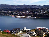
to take me across the bay to visit the satellite receiving station that they operate.
Michael drove me to the top of one of the tallest hills in the entire area and there,
perched at the highest point were two enormous concrete water tanks. These tanks
I learned are part of the Wellington water supply and therefore, are quite secure.
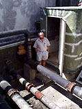
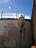
Michael led me through a well locked gate and up a rather steep ladder until we stood
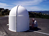
on the cement roof at the very top of one of the tanks. In the center of this tank
stood a bright white dome inside of which was their satellite receiving antenna.
 The signals from at least three different satellites are received by this antenna
and transmitted in real-time via a microwave link across the bay and directly to
the NIWA lab where it is processed and made available to support a wide number of
scientific projects. SeaWiFS (the Sea Viewing Wide Field of View Sensor) is one
of the satellites that this station collects and it is the project that I work on at
NASA.
 One such colleague of mine, Dr. Richard Murphy of NIWA happens to be based
at the Greta Point Laboratory and we met today and had a chance to actually
discuss face-to-face, some of the projects that he is involved with. Both
Richard and I work in a field called remote sensing, which can be broadly
defined as learning about something without being in direct contact with it.
In our case, the measurements we are interested in are those taken by
earth observation satellites orbiting over 700 kilometers around the subject
that we are interested in learning more about - Earth! You may think it is strange
to try and study the earth and in our case, the oceans from space, however,
there are many things that you can learn by taking a step back (in this case, a
very, very large step back) from the thing you are studying. Once we begin
the ocean-based part of this expedition off the waters of Kaikoura, I will be making
daily measurements of ocean and atmospheric conditions and will write in more
detail about the kind of research that can be done with satellites and why it is so
important to try and understand what they can tell us about our world and its ability
to support life as we know it.
 For the past five days, almost every waking hour has been focused
in one way or another on the giant squid. We have thawed, we have
measured, we have dissected, we have photographed and we have
tried without all too much success, to wash the remnants of
all these activities off of our bodies and clothes. Every once in
a while when we get into a taxi cab, or find ourselves in a very
small and painfully slow elevator, one of us invariably will turn
to the others and smile, knowing full well that we all know what
that means. We have all vowed that by the end of the week we
will find ourselves a laundromat and have everything that has come
within 10 feet of a squid thoroughly washed...several times if needed.


